Image: Pixabay
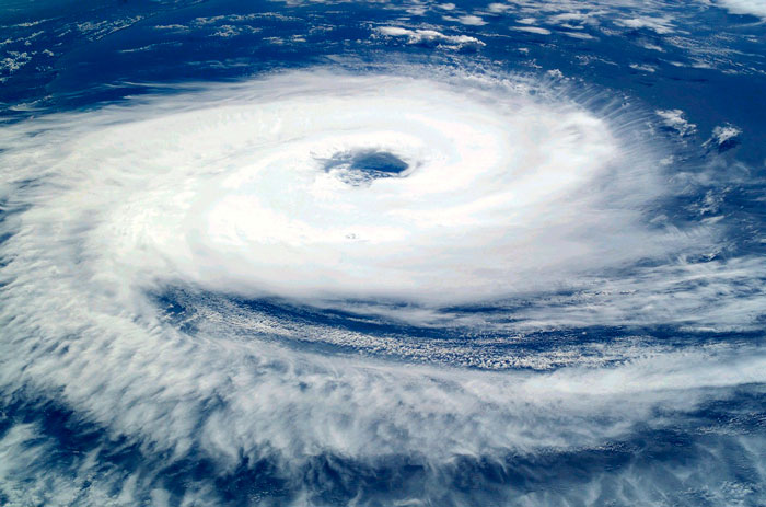
During this week, the strengthening of a low pressure region will give rise to a new extratropical cyclone over the southern region. Projections indicate that the formation of the system will occur from the afternoon of Wednesday (12), acting on the coast of Brazil until Friday (14).
One of the characteristics that has attracted attention in this event is the size of the maximum wind area. On Thursday morning (13), the radius of the cyclone (distance from the edge to the center), where these winds can occur, is approximately 950 km. Even with the low pressure core over the ocean, the region of Alegrete (RS ) up to São Paulo Capital can record intense winds.
{module Form RD}
Trajectory
Still on Wednesday morning, a region of low pressure advances from Paraguay towards the west of Rio Grande do Sul, where the system is expected to gain intensity. This reinforcement comes with the strong support of hot and humid air from the Amazon region, carried by winds known as Low Level Jets. The low pressure core is expected to cross the country towards the ocean, passing between the north of the State of Gaúcho and the south of Santa Catarina. The cyclone reaches the ocean on Thursday morning and will continue moving throughout the day, heading east. Even so, wind gusts will still be intense in the coastal region.
Winds
From Wednesday afternoon onwards, the winds can be intense in sectors of the southeast of Rio Grande do Sul. As the low pressure continues its trajectory, the winds will intensify and gain more scope, taking gusts to the south of Paraná. But it is from Thursday onwards – when the system reaches the ocean – that the winds tend to be stronger.
Gusts can vary from 70 to 90 km from southwest Gaúcho to the coast of São Paulo. The most intense winds are forecast for Thursday afternoon (13), where gusts can exceed 100 km/h from Torres (RS) to Morretes (PR). At sea, in the region of Laguna (SC), some projections indicate gusts of up to 134 km/h.
Rains
Along with the advance of the low pressure system, instabilities are expected to occur with strong intensity, bringing large volumes of rain in short periods of time. The most likely areas that will receive these intense rains are between the southeast of Santa Catarina and the south of Rio Grande do Sul.
Rain showers are expected to occur in two distinct periods. One with the displacement of the low pressure system, during Wednesday, and another with the establishment of the cyclone in the ocean, in the early hours and morning of Thursday.
Some instability is expected to advance to the south of Paraná, south of São Paulo and south of Mato Grosso do Sul. These rains advance as a cold front, resulting from the action of the cyclone and may be locally strong, but of short duration.
Hail
The rains from this event will be potentially heavy, accompanied by a lot of lightning activity, gales and chances of hail, both on Wednesday and Thursday.
Even though the index presents the highest conditions over southeastern Paraná and western Santa Catarina, the occurrence of the phenomenon over areas in the south of Rio Grande do Sul cannot be ruled out, especially in the early hours of Thursday.
Frosts
After the cyclone establishes itself in the ocean, the prevailing winds from the southern quadrant should drive a mass of cold air over Argentina towards central-southern Brazil. This should occur on the afternoon of Thursday (13th), but it is from Friday (14th) with clearer weather, that the frosts should occur.
Over the next few days, cold air heads towards areas of the southeast, mid-west and south of Rondônia. On Saturday there are conditions for frost in the south of Minas Gerais in addition to areas in the southern region of Brazil.
Source: Gabriel Rodrigues and Seane Lennon | Notícias Agrícolas
{module Read Also}


