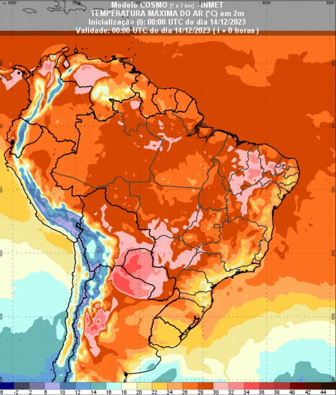
According to the most recent forecasts, from this Thursday (14th) the rains are expected to be even more irregular in the country's main producing sources. A high pressure system will gain strength and trigger a heat wave in the coming days. Also from today the temperatures start to rise.

“A cold front advanced over Rio Grande do Sul, but begins to move away towards the ocean this Thursday. The cold air from this cold front cannot advance over southern Brazil”, adds Climatempo.
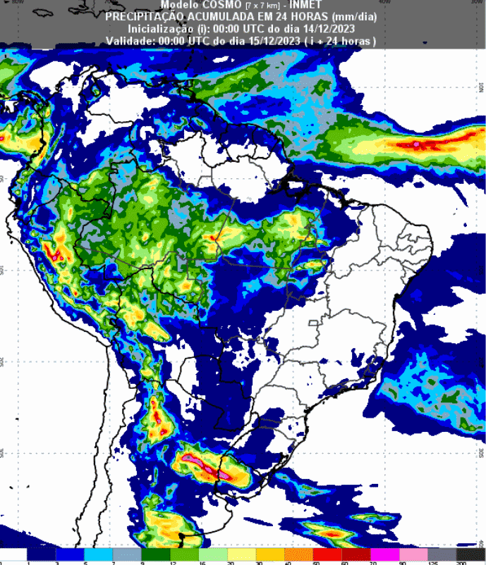
In the prediction of the Cosmo model from the National Institute of Meteorology (Inmet), it is possible to observe the formation of some clouds only in the western part of Brazil. Even so, the rain occurs irregularly and with low volumes. Inmet even maintains a state of alert for above-average temperatures in the coming days.
“There is a forecast of few rain showers with lightning, in the afternoon or early evening, in the central-western and northern part of the state of São Paulo. However, in the south of Minas, in the Zona da Mata Mineira, in the mountains and in the northwest of the state of Rio De Janeiro, some temporary rain showers may also occur. Some in addition, in Vitória and in the center south of Espírito Santo and in Vale do Rio Doce (MG)”, adds Climatempo for the Southeast.
See the precipitation forecast map for the next 93 hours:

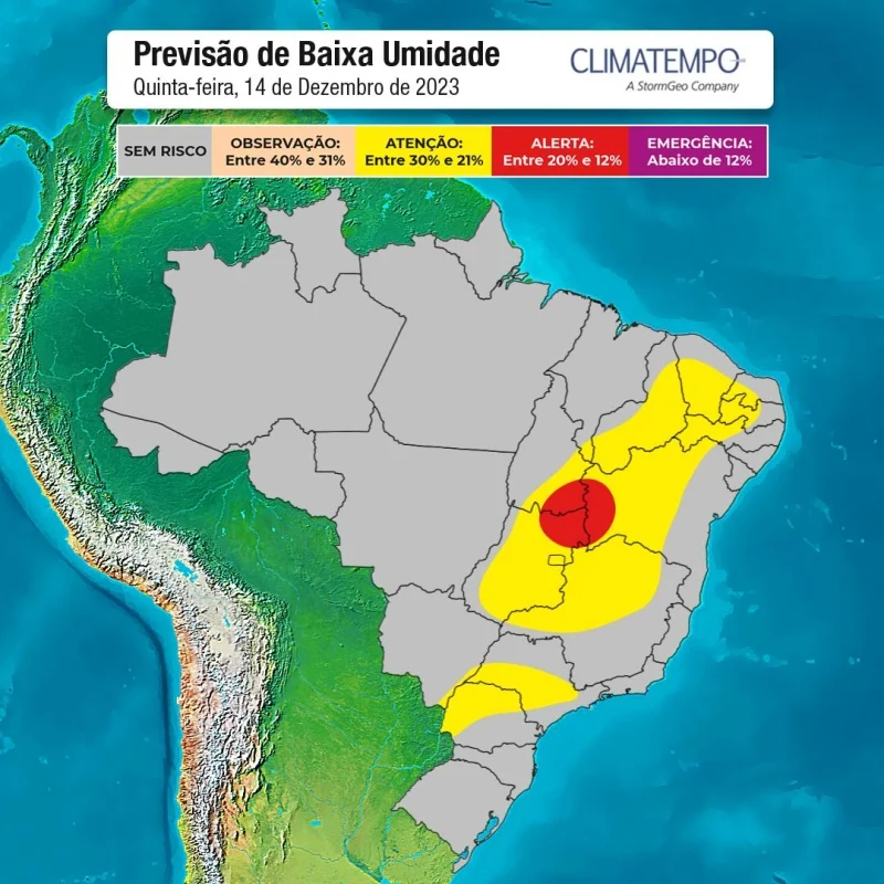
The dry and hot air mass will also favor a drop in humidity in much of the country. Climatempo warns of low humidity in areas of the Southeast, Central-West and Matopiba this Thursday (14). The most critical scenario is predicted in points in Goiás, western Bahia and Tocantins. Check it out on the map:

Source: Virgínia Alves | Notícias Agrícolas


