The forecast of new rains for the Brazilian territory, according to what the National Institute of Meteorology (Inmet) indicates, continues to be concentrated in the North Region, in the states of Acre, Amazonas, Roraima, Pará and Amapá, and, above all, the big River in the South, where expected volumes are higher.
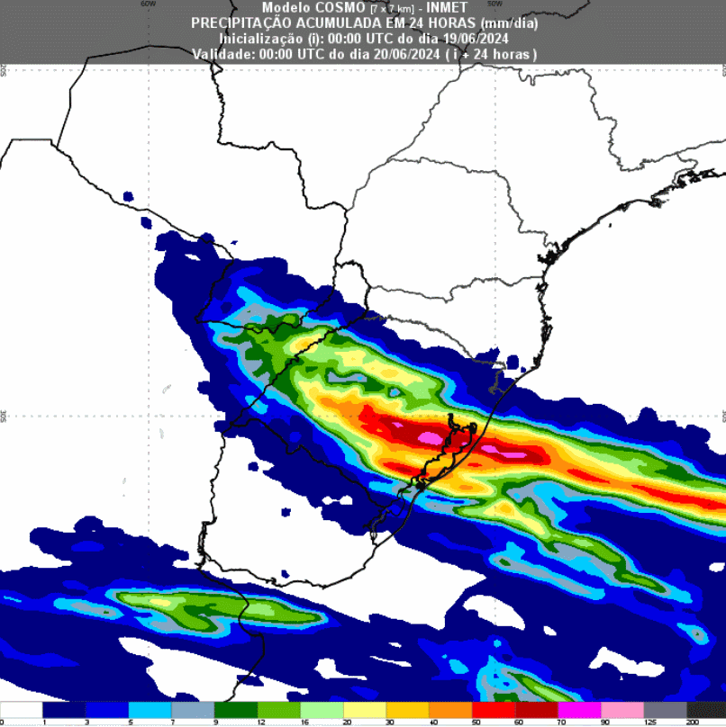
Between Tuesday (18) and this Wednesday (19), according to Metsul, a hot front caused heavy rain and storms with lightning and hail over Rio Grande do Sul. Municipalities in the west, center and the south of the state of Rio Grande do Sul recorded the highest volumes, with marks between 100 and 200 millimeters.
Storm warning: Heavy rain and danger of hail in Rio Grande do Sul
This Wednesday the rain continues and increases the accumulation in the central, southern and eastern areas of Rio Grande do Sul. For a large part of the state, Inmet issued a storm danger warning, lasting until 6pm this Thursday, to rain between 30 and 60 mm/h or 50 and 100 mm/day, intense winds, from 60 to 100 km/h, and hail.
Furthermore, inmet also indicates a new round of rain over Rio Grande do Sul next Monday (24). The rains should be concentrated over the north center of Rio Grande do Sul, including the Porto Alegre Metropolitan Region. Volumes must exceed 60 millimeters within 24 hours in some municipalities.

For the North region, lighter rain showers are forecast throughout the week, especially in areas further north of Amazonas, as well as in the states of Roraima and Amapá. In other areas, isolated rain showers with smaller accumulations cannot be ruled out. There is no indication of rain for Rondônia.
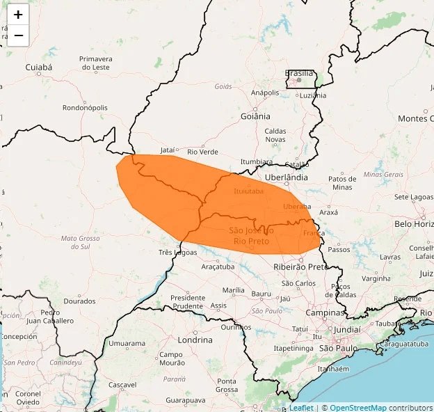
Meanwhile, all of Central Brazil, including almost the entire Northeast, continues to experience very dry weather and no new rain is expected. There is also a danger alert for low air humidity, varying between 20% and 12%. This is for the border between the states of São Paulo, Minas Gerais, Mato Grosso do Sul and Goiás.

Source: Igor Batista | Notícias Agrícolas


