Over the next few hours, a low pressure system will gain intensity between northern Argentina and Paraguay. As this happens, the rains have been increasing over Paraná, Mato Grosso do Sul, Santa Catarina and Rio Grande do Sul.
The region has been experiencing rainfall well above average over the last few months, which is a consequence of the El Niño phenomenon.
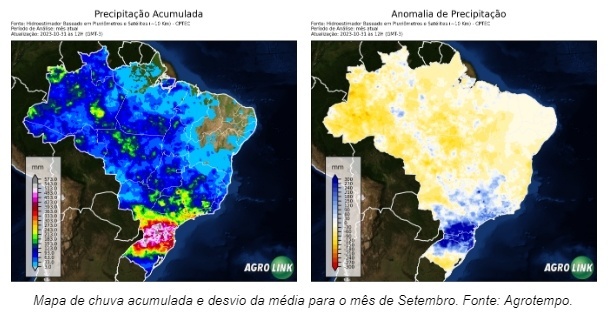
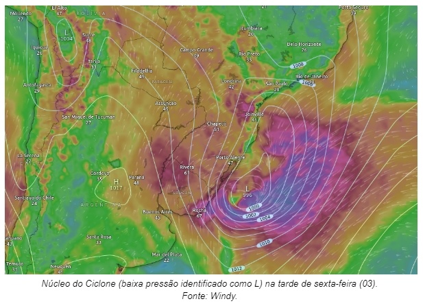
Occurrences of extratropical cyclones in spring are associated with El Niño conditions. Gabriel Rodrigues, meteorologist at Portal Agrolink, again, this low pressure area should give rise to another strong cyclone in the south of the country. This event will be relatively different from the last cyclones that have occurred in recent weeks.
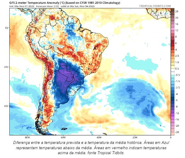
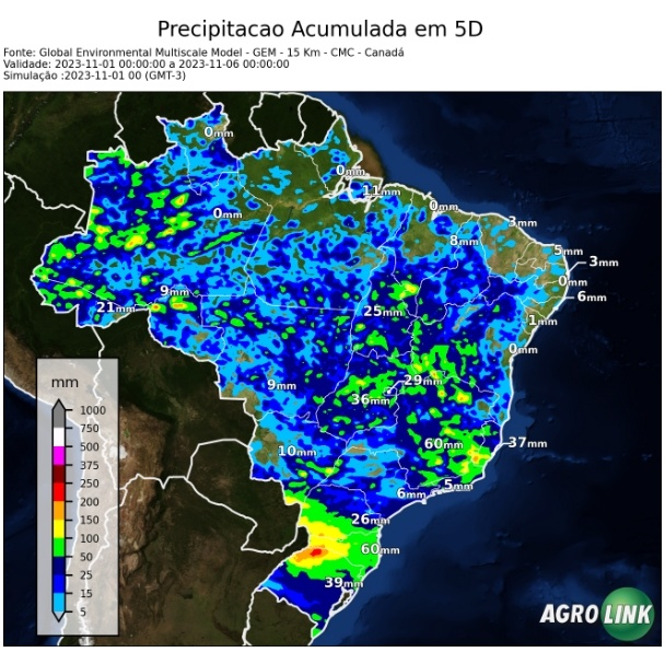
Projections indicate the push of a cold air mass towards the center of the country, minimizing the intense heat. Furthermore, with the formation of the cyclone, a cold front – a rain system – advances towards central sectors of Brazil, forming a broad moisture channel that covers the North, Central-West, Northeast and Southeast regions.
This humidity corridor will allow rain to be better distributed across the main soybean producing regions. And the scenario is positive, as the reduction in strong heat combined with better distribution, as well as the greater frequency of these rains, will allow soil moisture to be recovered more effectively.
The material was prepared by meteorologist, Gabriel Rodrigues with review by Aline Merladete.
Source: Aline Merladete | agrolink


